The Historic Sunset Highway
in Washington
North Bend to Snoqualmie Pass
The Historic Sunset Highway
in Washington
North Bend to Snoqualmie Pass
Olallie State Park
Olallie State Park is a 2,500 acre day use park east of North Bend that features dramatic waterfalls, cliff formations and old-growth trees. The park is a popular location for hiking, picnicking, fishing and rock climbing.
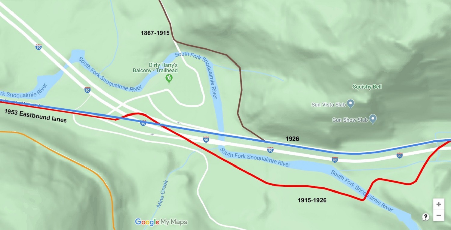
The first wagon road leading up the hill to Snoqualmie Pass from North Bend was the 1867 Snoqualmie Wagon Road. The original road continued eastward from North Bend at the truck stop on what is now known as SE Middle Fork Road. Just before SE lake Dorothy Rd., the 1867 road start to round the hill and climbing up to what was called "Hogs Back Ridge". The ridge was narrow with side dropping steeply on both sides of the road.
The road followed the Hogs Back Ridge to Grouse Ridge and then down the hill to the river. Between this point and the summit of Snoqualmie Pass the early wagon road crossed Snoqualmie River 17 times. In 1883, a toll company was formed to help improve and maintain the road. Hogsback Ridge was bypassed and a new road was constructed up the western side of Grouse Ridge. the new road connected to the old road at the top of the hill.
In 1912, the road up Grouse Ridge was improved again and this new road runs on what is now Grouse Ridge Road. In 1915 when the Sunset Highway was completed, a new road was built from the truck stop east of North Bend to the eastern side of the Snoqualmie River just beyond exit 38.
In 1926, the Sunset Highway was getting a complete makeover from end to end. The road through Olallie was straightened and new concrete bridges were installed. By the 1930's the road had been pave with concrete.
In 1953, the Sunset Highway was transforming into a modern freeway and 2 additional lanes were added. Through Olallie park the new lanes were added next to the existing roadway. The road then became a section of the new Interstate 90 in the 1960's and in 1976, the road that would become Olallie Park was bypassed for the new freeway that we see today.
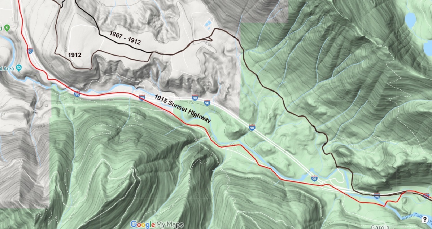
Map of the entire park 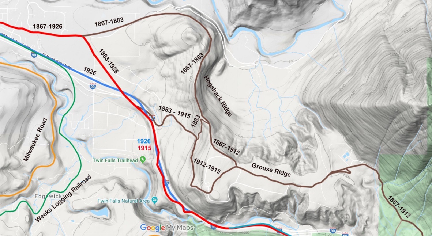
Map of Grouse Ridge 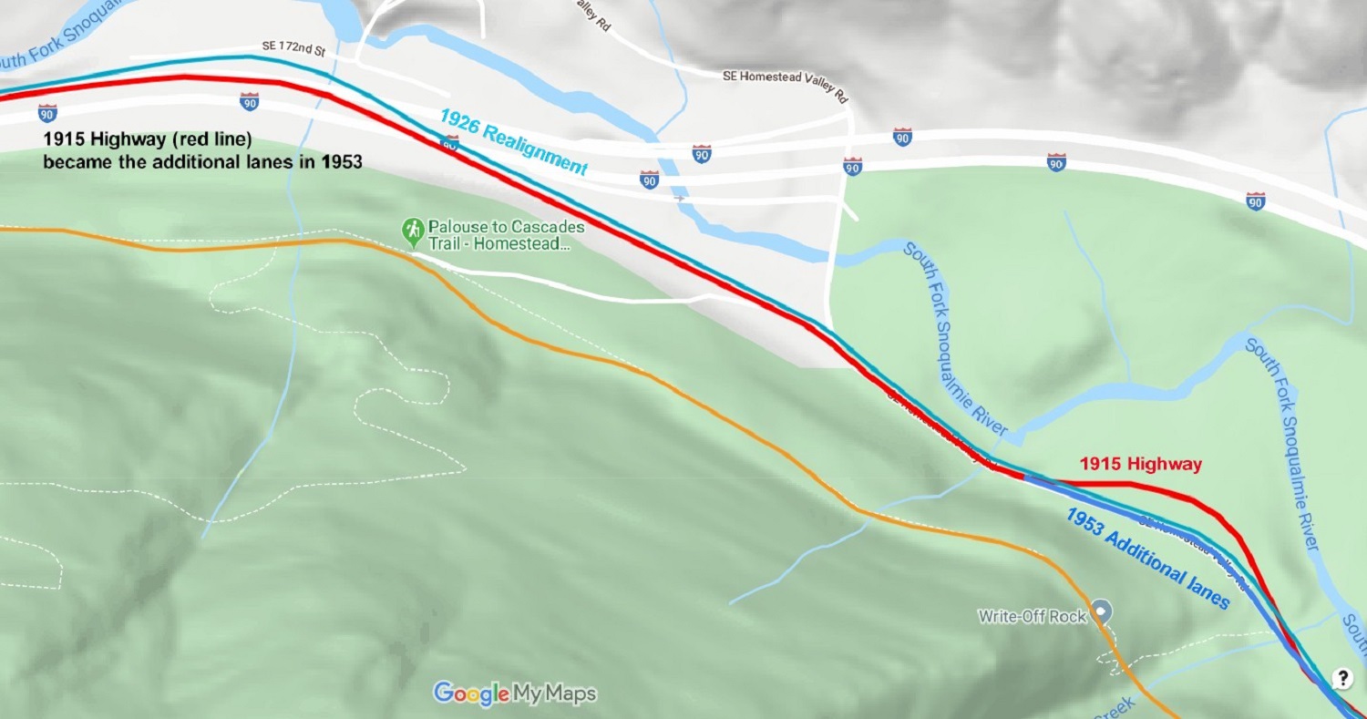
Western end of park 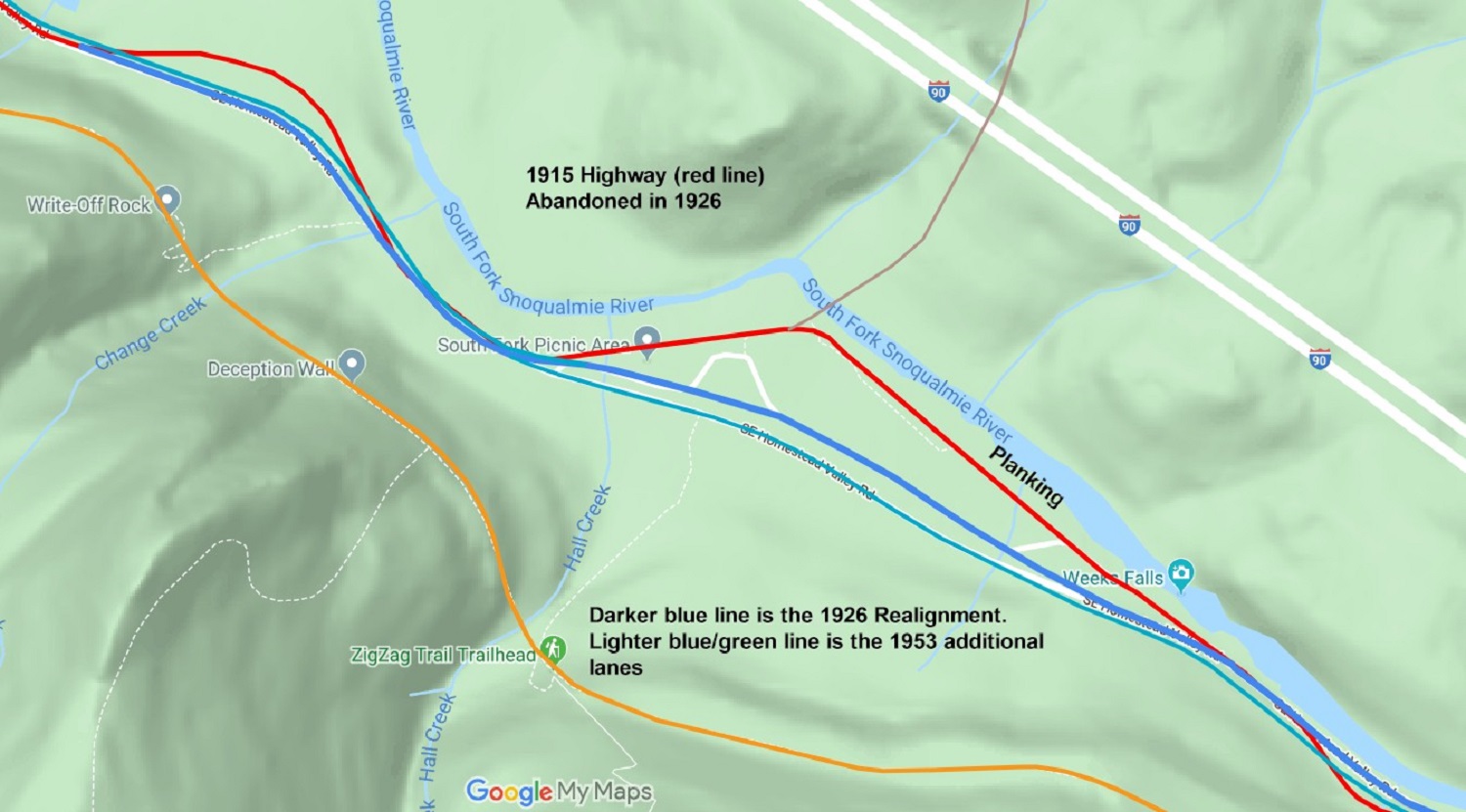
Middle of park |
Eastern end of park 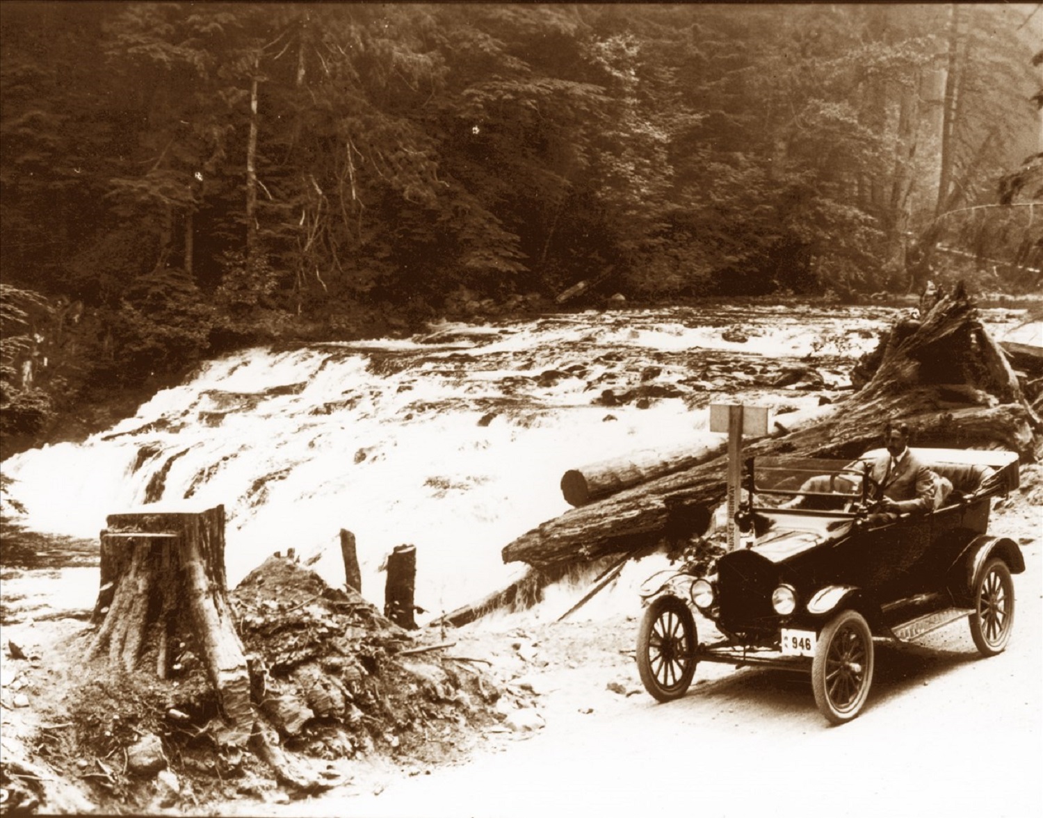
Weeks Falls 1918 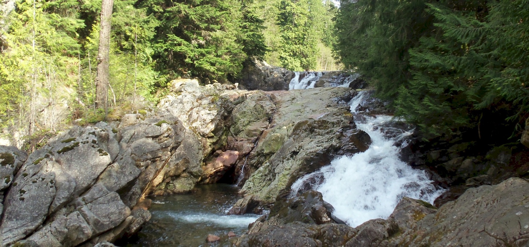
Weeks Falls in summer, 2017 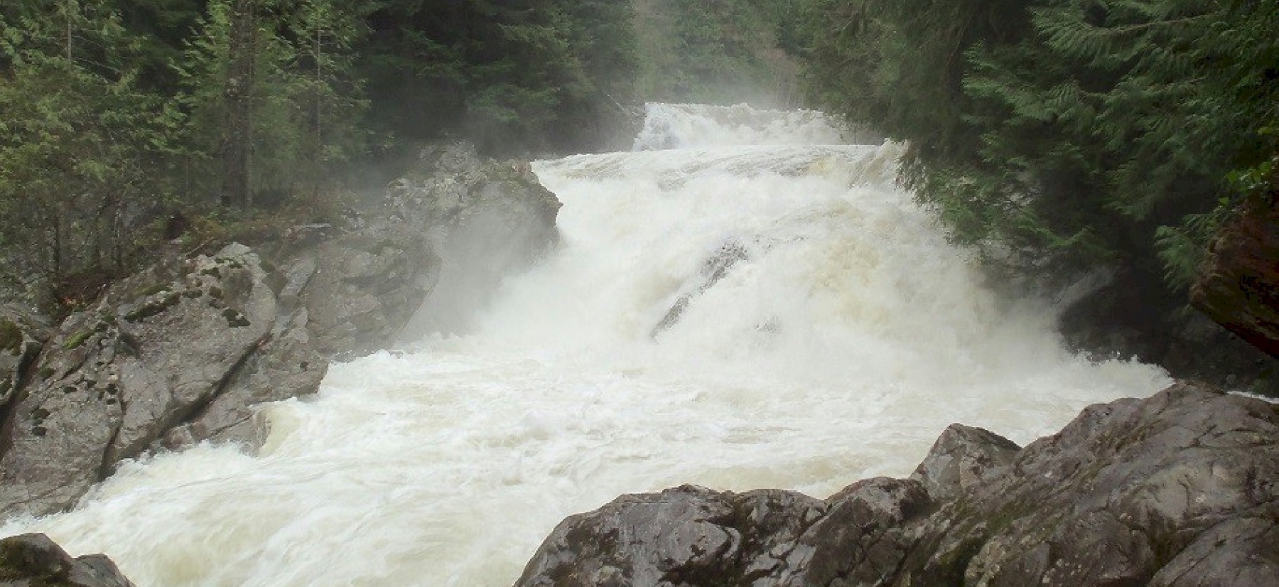
Weeks Falls in spring, 2016 |
![]()
©2014 - 2020 sunset-hwy.com
All Rights Reserved