The Historic Sunset Highway
in Washington
Vantage
The Historic Sunset Highway
in Washington
Vantage
Vantage
The area around Vantage has been occupied by the Wanapum Native Americans since prehistory. A number of well-preserved rock-paintings have been found on the cliff walls. They also used the abundant petrified wood in the area for arrowheads and other tools. The site where these petroglyphs were found was inundated by the rising waters behind Wanapum Dam in the 1960s. About 60 of the more than 300 carvings were cut from the basalt cliff face and saved. The nearby Ginkgo Petrified Forest site is one of the most unusual fossil forests in the world, and was designated a National Natural Landmark by the National Park Service in 1965.
In the early part of the 20th century, residents in nearby Ellensburg needed a more direct route when traveling east. So in 1914, a car ferry was established to carry traffic across the Columbia River at Vantage. This ferry was really just a small barge with wooden ramps at either end, and could carry only two cars at a time across the river. After several cars (some with occupants still in them) were lost overboard from the tiny ferry, the State Highway Department decided to construct a bridge over the Columbia.
In 1927, the 1640-foot bridge was opened at Vantage. This was an important link in the Sunset Highway. The construction of the bridge required workers to enter pressurized caissons 70 feet under the riverbed via airlocks. Some workers became seriously ill from the effects of the pressure. Once completed, the bridge had a 70-foot clearance on the center span, allowing for river traffic to pass under the bridge.
This cantilever bridge served until 1962, when it was replaced with the current bridge. The original bridge was dismantled, and moved to the crossing at Lyons Ferry, where it still stands today as the oldest extant steel cantilever bridge in Washington, and is listed in the National Register of Historic Places.
With completion of the Wanapum Dam in the early 1960s, the townsite was relocated further up the hill above the rising water to the current location.
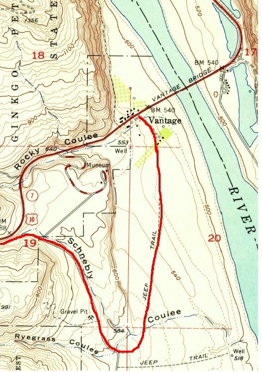
1954 Map 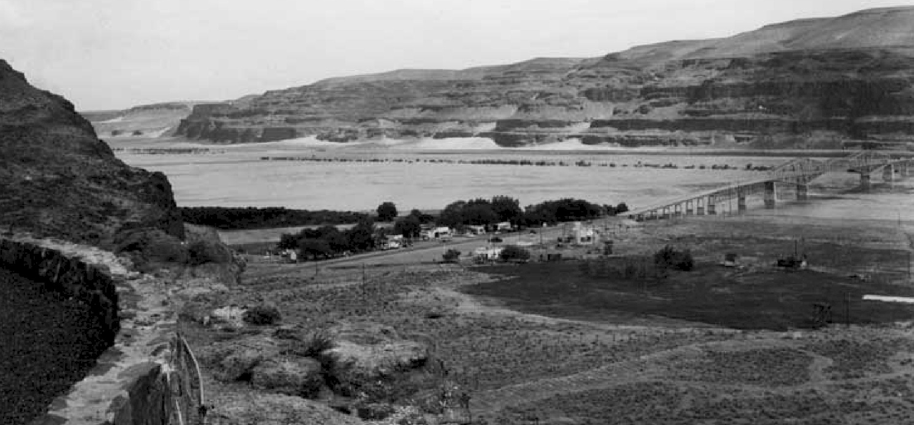
Vantage in the 1950's 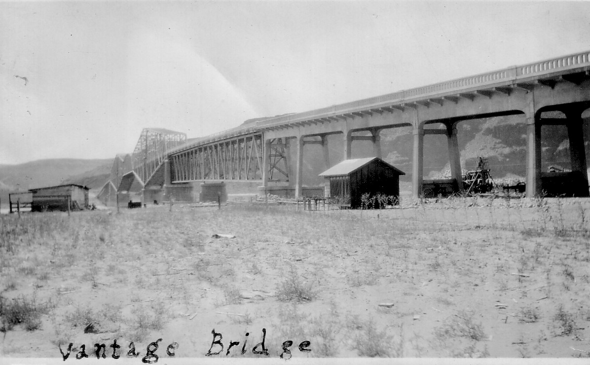
Vantage Bridge 1930's 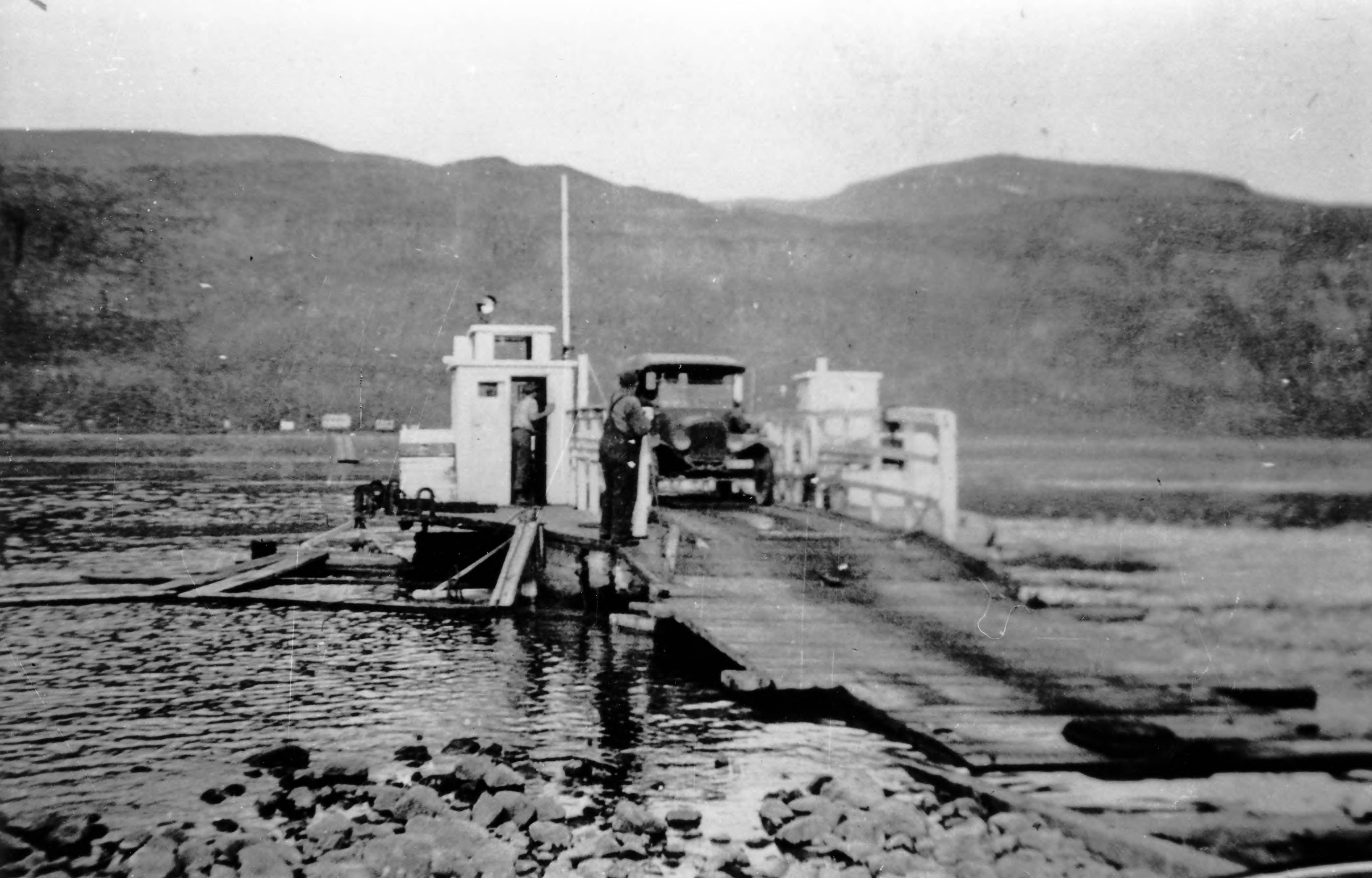
Vantage Ferry |
![]()
©2014 - 2020 sunset-hwy.com
All Rights Reserved