1 / 8
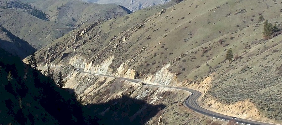
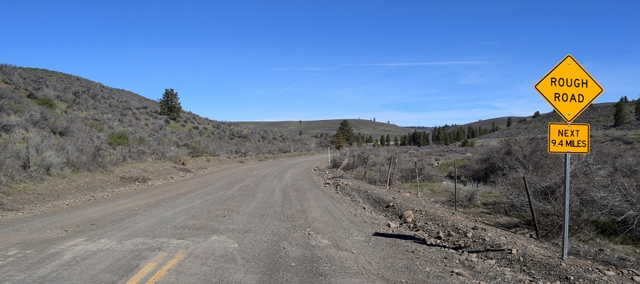
Corbaley Canyon
2 / 8
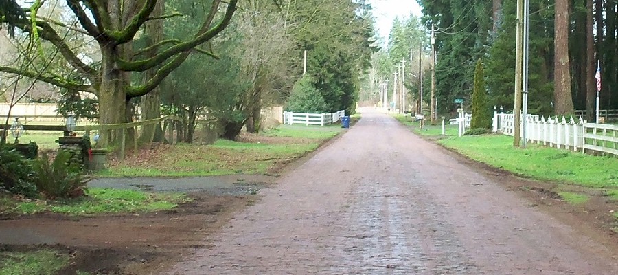
Red Brick Road
3 / 8
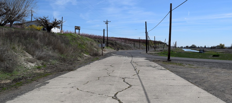
Buena
4 / 8
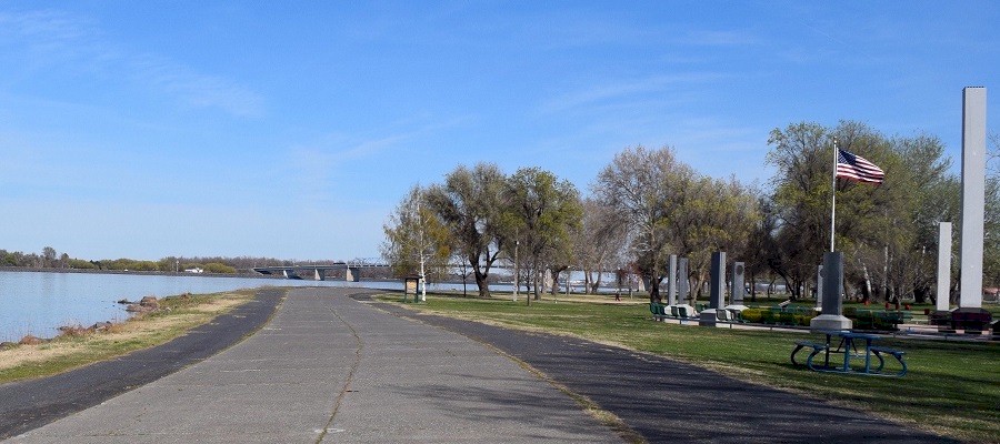
Kennewick
5 / 8
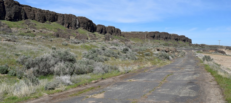
Wilcox
6 / 8
Thornton
7 / 8
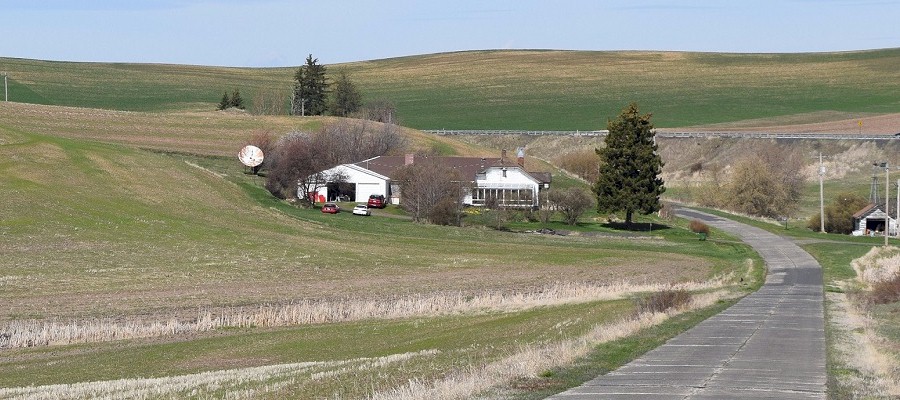
Prosser
8 / 8
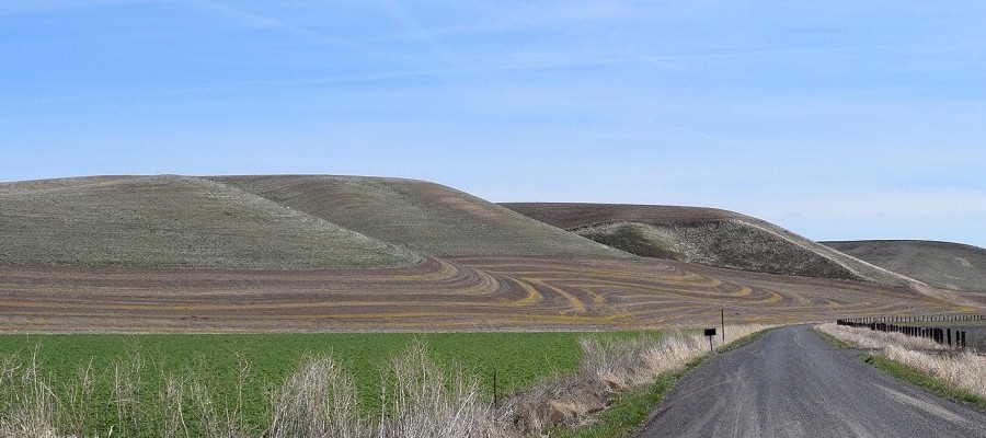
Wenas
The Historic Yellowstone Trail
in Washington
History of the Yellowstone Trail
The Yellowstone Trail was the first transcontinental automobile highway to cross the northern states from Plymouth, MA to Seattle, WA. The trail made Yellowstone National Park and the entire Pacific Northwest an accessible tourist destination for the automobile.
A Rhythmical Tale of a Noted Trail
You may have heard, but not in rhyme, How Parmley made his trip on time. They boasted down at Aberdeen the trip could not be done, but Studebaker had a man who said it could be done. The Yellowstone Trail is soft with rain, the Yellowstone Trail is new, but Nissen swore by the shirt he wore he'd put the big car through. They boasted down at Aberdeen that South Dakota Rain would keep a load of the soft spring road till shone the sun again. Three hundred fifty miles from Lemmon east until across the state, across the line, you come to Ortonville.
Before the Yellowstone Trail switched to the Sunset highway from Spokane to Seattle in 1925, the route from Fall City to Seattle went through Redmond and Kirkland. From Kirkland you then hopped onto a ferry across Lake Washington to the foot of Madison St. then up the hill into Seattle. This drive from Snoqualmie Falls to the site of the Kirkland ferry dock is about 20 miles. Even though the last 7 miles are now completely developed, most of this route is pretty much the same as it was 100 years ago.
Trip Report - Peshastin to Fall City
After driving east over Steven's pass we met up with the Yellowstone Trail as it turns south toward Blewett pass near the town of Peshastin. This part of the trail was the 1925 route which followed the Sunset Highway. The weather was great with lots of blue sky and sunshine. It was just above freezing in the morning, but later it had warmed up to 55 degrees. The road was bare and dry so we were in for nice drive.
The Yellowstone Trail from Ellensburg to Richland
Leaving Ellensburg going south, the Yellowstone Trail follows Main St. to Umptanum Rd., and then turned west over the freeway. We continued south on Umptanum Rd. which follows the old stagecoach route over Ellensburg pass to Wenas. In about 2 miles after crossing the river the road reaches the hill where the pavement ends. From here it is about 30 miles of a rough dirt road until you get to Wenas. After driving through Wenas, continue on N. Wenas Rd. all the way to Selah. In Selah you continue south on N. Wenas Rd. / SR-823 , and then take a left onto E. Naches Ave., then right onto S.1st St. / SR-823 and continue south.
Rediscovering the Southern route of the Yellowstone Trail in Washington State
We were coming from Seattle, so we drove east over Snoqualmie pass on interstate 90 to Thorp. At Thorp we drove over the old Thorp Hwy. to Ellensburg, which was built in the 1930's. At Ellensburg and had a quick breakfast, and then it was back on the trail. We wanted to take the original route south on Umptanum Rd. to Wenas, but it is a 30 mile dirt road, and is very rough in places, and I didn’t want to take this slow possibly dangerous route. Instead, we decided to make some time and took Interstate- 82 over the hill into Selah. I figured we could explore Wenas another time. (We did in a Prius) After a stop along the freeway going up out of Ellensburg we got a good photo of the town and surrounding area.
Fast Cars, Illegal Booze and the Yellowstone Trail
The Yellowstone Trail has been used by many people for business and pleasure. There were people going on vacation, trucks moving merchandise and farmers taking their harvest to market. While most of this activity was legal transport, there were some who used the trail to profit from their illegal enterprises. In 1915 Washington & Idaho voted to become "Dry States" by outlawing liquor sales on January 1, 1916. Even though liquor sales became illegal, the demand for it did not slow down.
Afloat on the Yellowstone Trail
The Yellowstone Trail (YT) across Washington State offers the traveler a wonderful experience with it's unique geography. As you head west toward Seattle you are treated to the breadbasket of the state with it's wide open spaces of rich farmland. Next is the climb up and over the Cascade Range and down the steep western slope. After a day of driving the final hurdle was the 4 mile ferry trip across Lake Washington before you reached Seattle. Lake Washington is 33 square miles wide, 22 miles long and about 2 to 3 miles wide.
The Old Blewett Pass Highway became a section of the Yellowstone Trail in 1925. The pass is located between Peshastin on the north end and the junction of US-97 and SR-970 (Lauderdale Junction) at the south end. The 13 mile section of the old highway was a spectacular yet harrowing ride with 248 curves on a narrow roadway as you climb along the side of a mountain to the summit which is 4,061 feet above sea level. Today this section is bypassed by the new highway.
Deep in the forest northwest of Lake Easton lies a part of the Yellowstone Trail which has been abandoned for 90 years. I call it the Ghost Highway. Why? Because a road is built to get you from one place to another, and this road goes nowhere, serves no purpose anymore, and nobody lives near it. This 4 mile section of the highway was built in 1915. But in a mere 12 years this part of the road would be abandoned for the new 1927 highway which bypassed this road. The new highway diverged from the old road at the top of Easton Hill. This is where Midway Park once stood. Midway Park was a campground with a few cabins, and a Signal gas station. Today, nothing remains of this place.
Traversing Wenas Road in a Prius
Exploring the Yellowstone Trail is a fun and enjoyable experience. Along the way there are plenty of places to refuel the car, spend the night or get a bite to eat. But there are some parts on the old trail where you should have a few days worth of food, a full tank of gas, and preferably a four wheel drive vehicle. Wenas Road is one of them. Before it became a part of the Yellowstone Trail in 1915, Wenas Road as it is known today was originally called the Shushuskin Road, named for an Upper Yakama man who lived at the north end. The road starts in Ellensburg then south over Ellensburg Pass to Yakima.
Washington State has many natural geological features that were created during and after the last Ice Age by the movement and then melting of the enormous glaciers. Before the glaciers came and carved out the coulees, the Juan de Fuca Tectonic Plate continued it's subduction under the northern portion of the western side of the North American Plate at the Cascadia subduction zone. Because of this movement, the Cascade Mountains were born.
Wine Touring along the Yellowstone Trail in Washington
The State of Washington is second to California in premium wine production and the industry generates millions of dollars each year. Washington wines are among the most respected in the world. In 2017, the Washington Wine Commission reported 900 wineries with 350 grape growers and 50,000 acres of vineyards. This is almost the same size as Napa Valley. Washington State is at the same latitude as the great French wine regions of Bordeaux and Burgundy.
Yellowstone Trail - Montana
In 1915, Yellowstone National Park was opened for automobile traffic, and in the first 10 days, 321 cars entered the park; 151 at the west entrance, 86 at the north entrance, 83 at the east entrance and 1 car entered at the south entrance. Vacationers who were traveling from the Pacific Northwest on the Yellowstone Trail could use a cut-off road southeast of Butte, Montana, that was the shortest and most direct route to the west entrance of the park. This cut-off road was also a shorter distance than the main route to Livingston and the north entrance to the park at Gardiner that was promoted by the YTA.
Pipestone Pass is located in the Rocky Mountains of Montana on the Continental Divide in Silver Bow County 10 miles south of Butte. The summit is at a height of 6,347 ft and the Yellowstone Trail crosses over this pass while on its way to the Pacific Ocean.
![]()
©2014 - 2023
sunset-hwy.com
All Rights Reserved